From the Dry Side...
Visiting Mauna Kea Observatories
--
High Altitude Hazards --
(Read this before you go!)
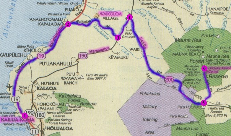
From Kona (1), follow Queen Ka'ahumanu Hwy past the airport -
at the Waikoloa turnoff (2), turn right-
travel mauka (up), past Waikoloa, to the end of the road (3),
turn left and drive to the Saddle Road intersection (4),
turn right onto Saddle Road (State Hwy 200),
continue until just past the 28 mile marker-
you will see a large cinder cone and gravel parking area to the right (5),
take a left (North) onto Mauna Kea Access road,
climb about 8 miles until you see the Onizuka Visitors Center (6) ,
a small stone building on your right.
W.M. Keck Observatory Homepage
Technical
Data for Keck Observatory
(Adobe PDF file, probably more than you want to know!)
Mauna
Kea Sunset
(Quicktime Move, 8mb)